Categories
Road Summary Travel

Summary: Red Rocks to Blue Waters

Red Rocks to Blue Waters
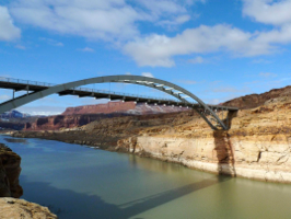
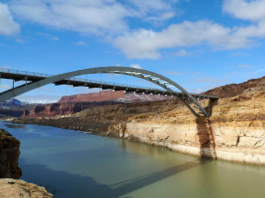
The Colorado River cuts a striking path through the Southwest. At times, man has built very impressive structures to adapt. This bridge is part of U.S. 95 which crosses the river just north of Hite, UT.

My path started with scouring New Mexico and ended with meandering San Francisco. Red rocks of Utah and the Great Basin of Nevada lie in between. My theme was just to get to MacWorld but there were so many delicious small trips along the way that I had to tie them together here.
linkedinmailby feather
Categories
Road Travel

Back Home Across the U.S.

Back Home Across the US
We agreed: deep south. DC had experienced terrible snow storms and Beth thought it best that I go south to avoid bad weather. Though I could have gone further south, this route worked just fine.

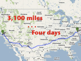
Averaging almost 800 miles per day, I had only the one goal of getting home. Five weeks is a long time to be away from family; I was homecoming-ready.

While not the most direct path, the route I drove was likely to avoid bad weather during the heart of winter. Very unlike me, I stayed on Interstate Highway System the whole time. It’s wildly difficult for me to fight the temptations of visiting attractions but I had a goal which helped. I wanted to learn how quickly I could cross the country by car. I now know: four days. The most direct path would have been six hours shorter so DC-to-SF can be done comfortably by a single driver in 3 1/2 days.

“Comfortably”?

linkedinmailby feather
Categories
Bike Road Travel

Riding Around San Francisco

Riding Around San Francisco
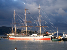
No matter where I go I come across National Park Services parks. This lovely ship was built in Scotland and sailed the world for over a century before retiring here at the U.S. Maritime Historic Park.

You can’t put me in a lovely bike-able setting on a gorgeous day and not expect me to head out. Without the bike I’d hike but my little foldable was just sitting there wanting to be ridden. The first afternoon I focused on familiar turf, the waterfront near where I was staying. That ride was around 14 miles in length while the following ride was 27 miles in length. The second ride was more a grand tour of the city’s periphery.

The first ride started off around Fisherman’s Wharf and continued all along the waterfront down into the industrial areas. Eighty percent of this ride was unbelievably nice but it got a bit uninteresting when all I saw were warehouses.

linkedinmailby feather
Categories
Bike Bridge Ocean Road Travel

Bike Ride of a Lifetime

Bike Ride of a Lifetime
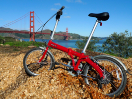
I bought this bike with the hopes of getting some use of it on this trip. Little did I know it would take me on some of the best rides of my life. Here it rests after having just conquered the Golden Gate Bridge.

I’d driven enough of the Marin Headlands to piece together a bike ride in case the weather cooperated … and it did! This area on the north side of the Golden Gate Bridge consists of federal parks and the town of Sausalito. All of it perfectly beautiful and all funneling into the Golden Gate Bridge. Why not bike it all and then across the bridge and back? Why not!

linkedinmailby feather
Categories
Lighthouse Ocean Road Travel

Point Bonita Lighthouse

Point Bonita Lighthouse
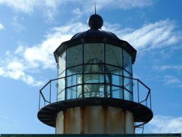
Inside is the light-bending centerpiece of all oil-fueled lighthouses, a Fresnel lens. To be seen far at sea it was important to channel all light into one horizontal beam. This French innovation was used in lighthouses worldwide.

Since 1968 I’ve wanted to visit this lighthouse which has guided ships to the Golden Gates for almost 150 years. From 1968 to 1971 I lived in the Bay Area while my father attended law school. Even then before the government started to free-up lands and build parks there was much to see and do. However, my recollection is that this lighthouse was off-limits and remains fairly inaccessible even today. Nowadays you can visit Point Bonita Lighthouse but only for three hours each Saturday and Sunday afternoon.

The bridge span to the lighthouse can only support two people at a time.

linkedinmailby feather
Categories
Bridge Road Travel

Bridge Beautiful

Bridge Beautiful
There’s no good reason to include this picture so I’ll tell you the selfish reason. It’s taken from Travis Sailing Center on the grounds of the Presidio Yacht Club. ‘Round these parts, my name isn’t rare.

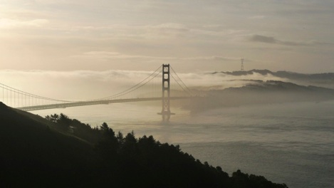
I woke and scampered to catch the Golden Gate Bridge at dawn. The day before had been terrible but that often clears the air. Though air polution isn’t a problem that stays around in this windy city, a rain and a cooling can reduce humidity. What I found didn’t match my expectations but it was beautiful.

Bridge Beautiful

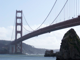
I spent the day sitting still for a change but was drawn outside by what turned into a nice day. Driving around the Marin Headlands was going to be useful to get my bearings and help me plan my time. Turns out it was also beneficial for seeing the bridge in a different, mid-day light.

linkedinmailby feather
Categories
Bike Historical River Road Travel

Circumnavigate Lake Tahoe

Circumnavigate Lake Tahoe
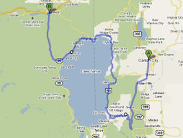
The map gives away the result. I was not able to drive all the way around Lake Tahoe because half way through a nasty snow storm hit and all I wanted to do at that point was to descend into the valley.

Several times I’ve driven segments of the road around Lake Tahoe. Over the course of three visits I still hadn’t driven the western shore. Today my goal was to make it happen … and it didn’t.

But I get ahead of myself!

linkedinmailby feather
Categories
Cave Desert Mountain Road Travel

The Loneliest Road in America

Lehman Caves
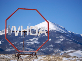
At 13,063 feet, Wheeler Peak is the tallest mountain in Nevada. While the sign is there to warn oncoming traffic at a “T” intersection, I found it comical to assume it was an expression of awe at the scale of the mountain.
Loneliest Road in America
Lincoln Highway

Everyone knows about the Rockies and the Colorado Plateau and everyone knows about the Sierra Nevada mountain ranges but what about the land in between? The region in between is called the Great Basin and is occupied largely by the State of Nevada. Filled with north-south mountain ranges separated by wide valleys (as seen above), what little water falls in this region stays in the region hence the name “basin”. It’s across this ripply arid land that I drove today.

linkedinmailby feather
Categories
Canyon Road Travel

Deeply Impressive Zion

Zion Canyon
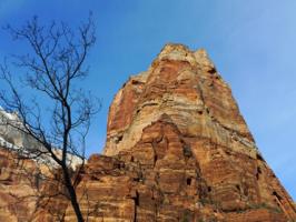
I had ambitions of riding my bike up and down the six-mile length of the canyon. The day was perfect for it but the timing wasn’t. The flat tire had thrown a kink in to my day’s schedule.

I awoke to a flat tire in the middle of nowhere. Bryce Canyon to my east and Zion Canyon to my west, I was smack dab in the middle of nowhere with no repair services for tens of miles. No matter! As a road warrior I’ve become adept at changing tires and getting repairs. This time was no exception but tire repair would have to wait because Zion Canyon National Park was calling.

linkedinmailby feather
Categories
Bridge Canyon Mountain River Road Travel

Southern Utah Rocks

Southern Utah Rocks
You drive across it but unless you make the point to step out and look at it, you don’t properly appreciate its beauty. This bridge crosses Cataract Canyon over the Colorado River near Hite.

The title of this post is adapted from my favorite National Parks T-shirt. The pun is obvious; this is the world’s mecca of red rock landscapes. The circuit of the entire set of red rock parks in this region is known as the Grand Circle.

linkedinmailby feather