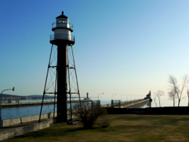
My drive across the great middle of this country ended when I arrived at Duluth on the extreme southwest shore of Lake Superior. For a city whose average annual temperature is 37 degrees, I found the climate in mid-April to be very comfortable.
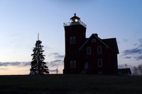
 So much did I enjoy being in the Duluth area that rather than check-in and regroup I decided instead to keep driving along the famed North Shore Drive. It was a beautiful excursion! The road shoots north from Duluth along water’s edge. I followed the road to Two Harbors where I found its namesake lighthouse. As usual at day’s end I was fighting the fading sun so I opted to take this silhouette shot of the lovely light. Two Harbor Lighthouse now operates as a bed and breakfast and, had I only known, it could have been my home for the night! The sign which read “Rooms Available” still burns in my brain.
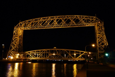
After I got back and had checked-in, the brilliant evening weather called me out to walk the waterfront. It was Friday night and the place was hopping! Since the 1980s the waterfront of Duluth has been redeveloped and is now a mecca of restaurants, parks, museums, and other attractions. Its central feature is the famous Arial Lift Bridge which can be raised in under a minute to allow boats to pass from Lake Superior into Duluth’s harbor.
The following morning I returned to the waterfront for a bike ride. What a pleasure! Then, after checking out and grabbing a Venti Bold at Starbucks, I continued my journey down Highway 2.
The morning was spent along the southern coast of Lake Superior where the featured highlight was Apostle Islands National Lakeshore. Twenty one islands closely clustered and restored to original forest land make up this little jewel. Especially for kayaking, I can imagine this being a great vacation spot. So too would Isle Royale National Park in upper Lake Superior when it finally thaws come summer.
Towards mid-day Highway 2 took a turn south and ran along the north coast of Lake Michigan, a stretch I drove only a few months ago. Having hunted lighthouses there so recently, I didn’t put much effort into shooting pictures. Instead I visited a few lights I had previously enjoyed and headed toward Saint Ignace where I hoped to see the famous Macinack Bridge by night.
I did.

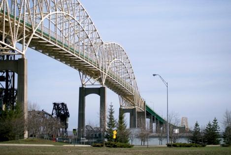
From there my drive turned north and ended at the border with Canada in a town called Sault Ste. Marie where I spent the night. It is here that Lake Superior connects to Lake Huron via rapids and a network of shipping canals. It is also here where the western portion of Highway 2 comes to an end. To continue my trip I’d have to pass over the Great Lakes via Canada and rejoin Highway 2 in the northeast corner of New York. To do so, I’d have to start by passing over the bridge pictured below and entering in to Canada.

